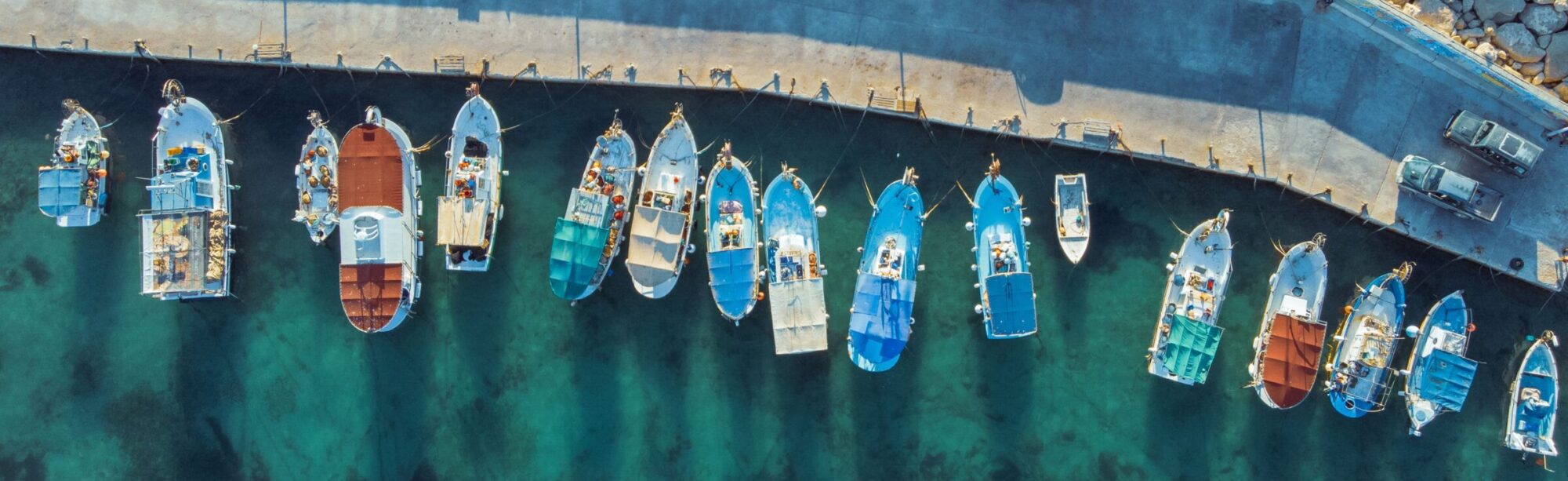
 Initiatives
Search for marine and maritime programs, projects and initiatives across the Mediterranean by using the search feature below or browse on the map. You can upload your initiative, project or programme through the “UPLOAD NEW” option.
EurOcean
EurOcean - The European Centre for Information on Marine Science and Technology, established in 2002, is an independent scientific non-governmental body consisting of members including leading European marine organisations whose(...) Read more.
- Geographical coverageRegional (only Mediterranean sea basin) |
EuroLex
The database is managed by the Publications Office of the European Union which acts in the name of all the institutions. The institutions participate regularly in the developments of the(...) Read more.
- Geographical coverageRegional (only Mediterranean sea basin) |
EuroMed Transport Library
The system is managed by EuropeAid Development and Co-operation Directorate-General (DG AIDCO) and Directorate-General for Mobility and Transport (DG TREN). The library includes More than 1,200 references (book, publications, studies,(...) Read more.
- Geographical coverageMediterranean (widespread) |
European Atlas of the Seas
“The European Atlas of the Seas is an easy and fun way for professionals, students and anyone interested to learn more about Europe's seas and coasts, their environment, related human(...) Read more.
- Geographical coverageRegional (only Mediterranean sea basin) |
Geo-Seas
EU-Seased aims at improving coordination, cooperation and the exchange as well as accessibility of information amongst European scientists in the field of the Sedimentology and integrates three projects: EUMARSIN, EUROCORE(...) Read more.
- Geographical coverageRegional (only Mediterranean sea basin) |
FAO Systems on Fisheries and Aquaculture
The Fisheries and Aquaculture Department systems are developed by FAO, Fisheries and Aquaculture Department (FI). The FAO GeoNetwork is implemented by FAO and World Food Program (WFP), United Nations Environmental(...) Read more.
- Geographical coverageGlobal |
FAO's Fishery and Resources Monitoring System
FIRMS is operated under a Partnership Arrangement which was launched in February 2004 upon signature of the Arrangement by the first five FIRMS Partners. The Partnership was launched with FAO(...) Read more.
- Geographical coverageGlobal |
Group on Earth Observations
The GEO portal is a gateway to global Earth Observation data, information and services developed by the European Space Agency (ESA) in collaboration with the Food and Agriculture Organization of(...) Read more.
- Geographical coverageGlobal |
General Fisheries Commission for the Mediterranean
The GFCM is the General Fisheries Commission for the Mediterranean, under FAO. Consisting of 23 Member countries along with the European Union, the GFCM’s objectives are to promote the development,(...) Read more.
- Geographical coverageMediterranean (widespread) |
European Maritime Safety Agency
EMSA (the European Maritime Safety Agency) operates and manages a suite of systems which receive, process, and distribute information on vessel traffic reports (LRIT, SafeSeaNet), satellite monitoring (CleanSeaNet), and Port(...) Read more.
- Geographical coverageRegional (only Mediterranean sea basin) |
The European Marine Observation and Data Network
The European Marine Observation and Data Network (EMODnet) is a long term marine data initiative from the European Commission Directorate-General for Maritime Affairs and Fisheries (DG MARE) underpinning its Marine(...) Read more.
- Geographical coverageRegional (only Mediterranean sea basin) |
Copernicus
Copernicus is a European system for monitoring the Earth. It consists of a complex set of systems which collect data from multiple sources: earth observation satellites and in situ sensors(...) Read more.
- Geographical coverageGlobal |
Marine Metadata Interoperability
The University of California, San Diego, leads the development and maintenance of the Marine Metadata Interoperability (MMI) website, while contributions come from major marine science agencies and institutions around the(...) Read more.
- Geographical coverageGlobal |
International Coastal Atlas Network
ICAN is an integrated coastal web atlas that currently focuses on costal erosion use cases. ICAN aims to become a one-stop shop for finding, visualising, and downloading data from distributed(...) Read more.
- Geographical coverageGlobal |
Maritime Integrated Decision Support Information System
The development of MIDSIS (Maritime Integrated Decision Support Information System) has the aim at assisting a person to take decisions towards a plausible response measures when a hazardous material marine(...) Read more.
- Geographical coverageMediterranean (widespread) |